
Why Robotaxis Are Still 'Coming Soon': The Perception Problems That Still Need Solving
Robotaxis are no longer a concept. They are operating on real roads, in real cities, carrying paying passengers.
Waymo has reported more than 400,000 rides per week across six major U.S. metropolitan areas, making it one of the clearest examples of robotaxi commercialization at scale. [1] The technology has crossed the threshold from demonstration to early commercialization, even as large-scale deployment remains limited to carefully validated operating domains.
Still, expansion remains cautious and geographically limited. Before entering a new city, operators must spend months mapping the area, securing regulatory approval, and validating performance before paying passengers can ride. The technology is already real, but the path toward truly unrestricted autonomous operation has proven longer than many initially expected. At the center of that challenge is perception: how well a vehicle can understand its surroundings when conditions are less than ideal, and what happens when there is no human backup to take over.
Where Camera and LiDAR Perception Falls Short
Most robotaxi systems today rely on some combination of cameras, LiDAR and radar. Cameras provide high-resolution visual information but are fundamentally optical sensors — rain, fog, snow, and low-angle sun glare can reduce image quality in ways that affect detection reliability. LiDAR provides precise three-dimensional spatial data, but it is also an optical sensor. Rain and fog can introduce noise into LiDAR point clouds through backscattering and attenuation, degrading object detection accuracy in exactly the conditions where reliable perception matters most. [2]
European regulatory direction also reflects this reality. The EU’s vehicle safety framework for automated and driverless vehicles emphasizes approval, validation and operational safety across defined operating conditions, reinforcing the need for perception systems that can perform reliably beyond ideal weather and lighting scenarios. [3] The technical debate between LiDAR-equipped stacks and vision-first architectures has continued without consensus. But among many Level 4 robotaxi operators, sensor redundancy, rather than reliance on a single modality, remains central to expanding safely across more complex operating conditions. [4]

Why Radar's Role Is Growing
Radar operates on millimeter-wave frequencies and does not rely on visible light, which makes it less sensitive to conditions that degrade cameras and LiDAR. Rain, fog, snow, and darkness can limit optical sensing, while radar is widely used as a complementary modality for perception in adverse conditions. In autonomous driving systems, radar’s value is strongest when it is combined with cameras and LiDAR as part of a broader sensor-fusion architecture. [4]
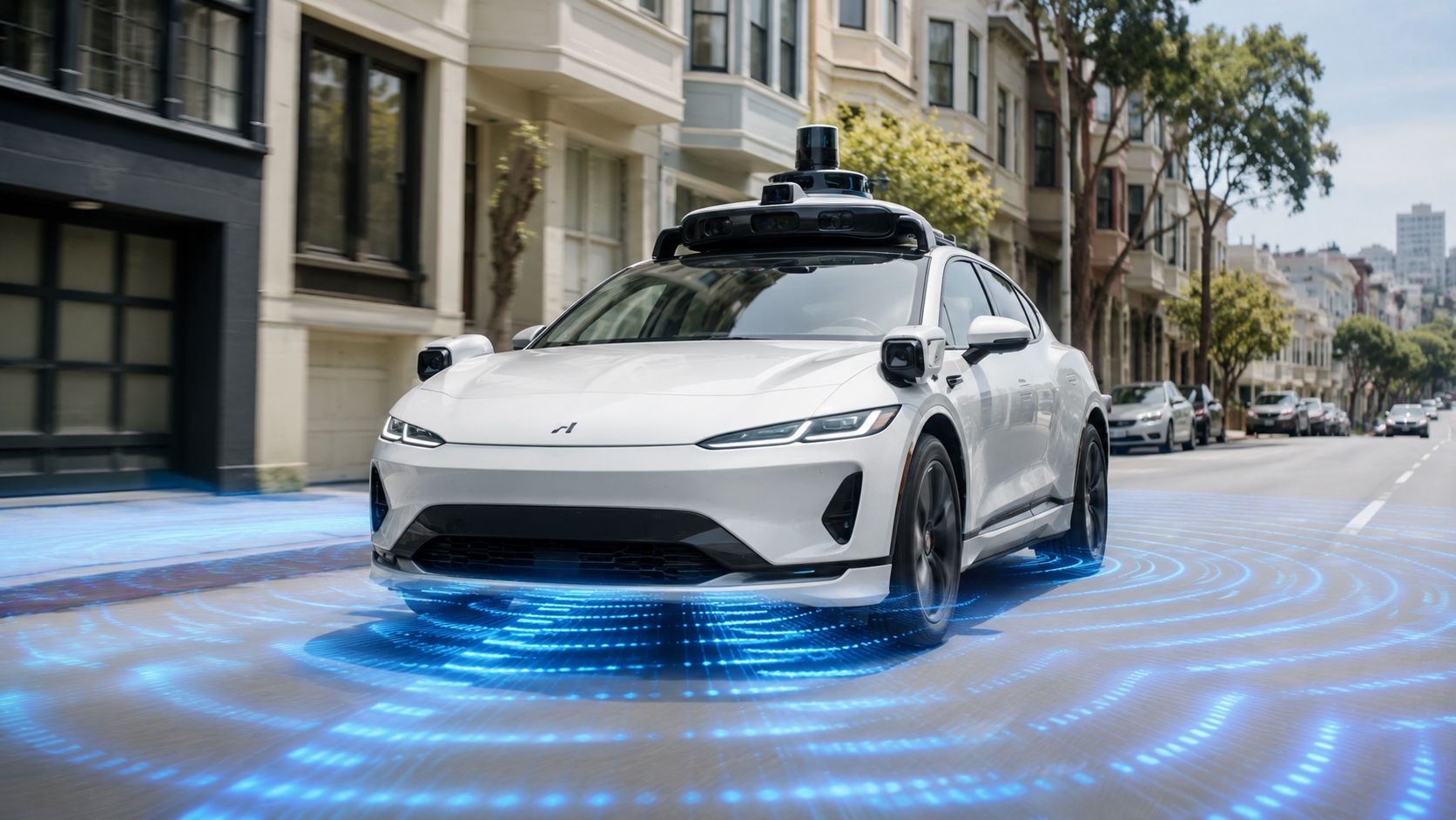
Leading Level 4 robotaxi operators reflect this multi-sensor approach. Waymo's 6th-generation Driver uses 13 cameras, 4 LiDAR sensors, and 6 radar units — a configuration designed to provide overlapping views of the vehicle’s surroundings and support operation across more complex environments. [5] 4D imaging radar adds elevation data to range, azimuth and velocity measurements, helping perception systems better understand object position and movement in three-dimensional space.

Why the Pace of Deployment Remains Measured
The robotaxi industry is scaling. But the careful, city-by-city approach that characterizes deployment today reflects a realistic assessment of where perception reliability currently stands. Even advanced robotaxi systems still require continuous validation, operational monitoring and improvement before they can expand reliably across broader geographies and more complex driving conditions. Financial scale and broad market profitability also remain longer-term goals rather than solved problems.
The sensors, architectures and data required to close the remaining perception gaps exist today. What the industry is working through is the process of integrating them reliably, validating them at scale and building the operational infrastructure that commercial deployment requires. The pace of that process is what determines when robotaxis stop being “coming soon” and become simply available.
The Role of 4D Radar in the Perception Stack
The remaining perception challenges in the robotaxi industry are not problems that any single sensor or solution can solve on its own. Better sensing in the conditions that matter most, better sensor fusion and broader access to the data those sensors generate all need to come together.
bitsensing's AIR4D is designed to play one part in that equation. A high-resolution 4D imaging radar for autonomous vehicle development, it provides access to radar data outputs; including point cloud, Doppler, and raw radar data, so that AV development teams can train and refine perception models using real sensor data. With an average power consumption of 13W, it is designed to support the stability requirements of long-term fleet operation. [6]
Reference
[2] Evaluating LiDAR Perception Algorithms for All-Weather Autonomy. Sensors, MDPI (2025).
[3] Vehicle safety and automated/connected vehicles. European Commission.
[4] Sensor and Sensor Fusion Technology in Autonomous Vehicles: A Review. Sensors / PMC (2021).
[5] Meet the 6th-generation Waymo Driver. Waymo Blog (2024).
[6] AIR4D Imaging Radar: A 4D Radar Purpose-Built for Autonomous Vehicles. bitsensing Blog (2026).