
AIR4D Imaging Radar: A 4D Radar Purpose-Built for Autonomous Vehicles
The autonomous vehicle industry has a perception problem — and it isn't about sensors.
It is about data. Specifically, access to the raw, high-resolution sensor data that AV AI models need to learn, improve, and perform reliably in the real world. Most 4D radar solutions on the market today operate as closed systems — processing data internally and delivering a filtered output. What AV developers don't get is the raw data itself. And that gap has been slowing down the commercialization of autonomous driving.
bitsensing’s newly launched AIR4D Imaging Radar is a 4D radar built from the ground up for autonomous vehicles, designed to close that gap.
Why Most 4D Radars Weren't Built for AVs
4D imaging radar has become an essential part of the conversation around autonomous perception. Unlike conventional 3D radar — which measures range, azimuth, and velocity — 4D radar adds elevation data. This means an AV can distinguish a pedestrian from a vehicle, or a road sign from an obstacle. It gets a high-resolution, real-time spatial picture of its environment across four dimensions.
But there is a problem with most 4D radars currently available: they were not designed for autonomous vehicles. They were developed for Advanced Driver Assistance Systems(ADAS) in passenger cars — a fundamentally different use case. Traditional automotive radar was designed mainly for ADAS functions, where the radar itself processes and simplifies the environment into predefined outputs. That works for functions like ACC or AEB, but it limits flexibility for autonomous driving companies developing their own perception and AI stacks.
The data those radars produce reflects that origin. And AV companies have had to work around it.
What AIR4D Does Differently
AIR4D was designed with one question in mind: what does an autonomous vehicle actually need from its radar?
The answer starts with data access. AIR4D gives AV companies direct access to high-resolution 4D sensor data — including point cloud data, Doppler data, and crucially, raw radar outputs. Access to raw or intermediate radar data changes the development approach significantly. AV developers can work directly with richer radar information — including Doppler, elevation, and signal-level characteristics — instead of relying only on filtered object lists or fixed point cloud outputs. This allows radar to become a more active part of perception and sensor fusion rather than simply a secondary validation sensor.
It also givesAV companies more freedom to optimize how radar data is fused, interpreted, and trained within their own autonomous driving architectures. This is the data that perception engineers need to continuously refine their models, validate performance in real-world conditions, and move from testing to large-scale deployment with confidence.
Beyond data access, AIR4D is also optimized for the specific demands of AV operation: power efficiency and thermal management. Higher radar resolution typically requires more processing, larger data throughput, and more complex antenna architectures— increasing power consumption and thermal load. For AV systems operating continuously at fleet scale, those trade-offs become critical because power efficiency, heat management, reliability, and hardware cost directly affect commercial scalability. AIR4D was engineered to balance perception performance with operational efficiency.
In Dr. Jae-Eun Lee's words: "By delivering high-resolution 4D perception data, including, importantly, all raw data outputs, our goal at bitsensing is to empower autonomous vehicle companies to build systems at speed and at scale."
How Elevation Data Changes Object Classification
One of the most significant capabilities that 4D radar brings to autonomous perception is elevation. It is also one of the most underappreciated.
Traditional 3D radar can detect range, speed, and horizontal position, but it has limited understanding of an object's vertical shape or height. By adding elevation data, 4D radar improves object separation and helps autonomous systems better interpret whether an object is actually blocking the vehicle's path.
For example, without elevation information, it can be more difficult to distinguish between a large overhead road sign or pedestrian overpass — which the vehicle can safely pass under — versus a tall obstacle that would result in a collision. Elevation also helps separate roadside infrastructure from vehicles or pedestrians in dense urban environments.
Pedestrians typically exhibit smaller and more irregular motion patterns, while vehicles have larger structures, more consistent movement trajectories, and different velocity behaviors. Elevation data also helps determine whether an object is elevated, passable, roadside infrastructure, or directly within the vehicle's path. The result is more stable object classification and environmental understanding across a wider range of real-world driving conditions — including nighttime, adverse weather, and partially occluded environments where camera-only systems can struggle.
This does not mean radar replaces every other sensor. The goal is improving reliability, redundancy, and environmental understanding in situations where vision-based systems alone become less dependable —particularly for AV deployments operating continuously across diverse weather and lighting conditions.

The Challenge of Radar–Camera Fusion at Scale
A camera-plus-radar architecture is only as good as the fusion between the two. And fusion at fleet scale is genuinely hard.
The biggest challenges are time alignment, spatial calibration, and consistency across many vehicles. Radar and cameras operate differently: cameras capture rich visual scenes, while radar measures range, velocity, angle, and reflections. To fuse them accurately, the system needs precise timestamps, stable extrinsic calibration, and reliable matching between radar points and image features.
At fleet scale, this becomes harder because sensor mounting tolerances, vibration, temperature changes, maintenance, and vehicle-to-vehicle variation can shift calibration over time. Recent radar-camera calibration research also points out that accurate extrinsic calibration is essential and that finding reliable correspondences between radar and camera data remains an open engineering challenge.
These are the constraints that AIR4D was designed with in mind — and the reason that bitsensing's engineering approach prioritizes not just sensor performance, but the integration and calibration infrastructure needed to make radar-camera fusion reliable in real-world deployment.
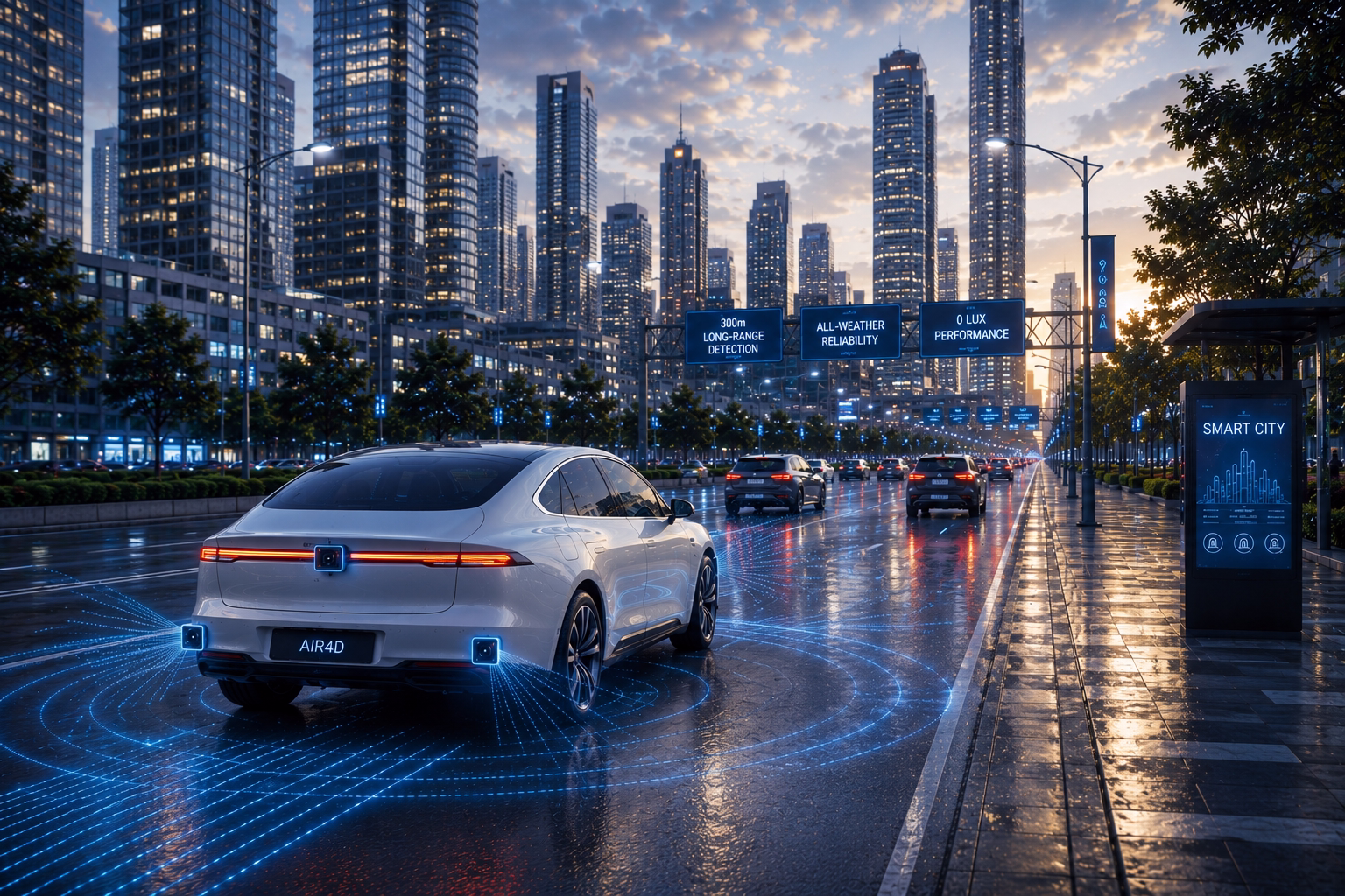
Real-World Performance, Not Just Test Track Performance
Autonomous vehicles are not tested in ideal conditions — they operate in all of them. AIR4D is built to match that reality.
Key capabilities:
- Long-range detection up to 300m: vehicles, pedestrians, and obstacles are identified farther down the road, giving the AV more time to make safe decisions.
- Direct velocity per object: AIR4D measures how fast every surrounding object is moving in real time — enabling faster, more accurate decision-making.
- Zero-lux performance: the radar operates in near-total darkness, maintaining full environmental awareness in conditions where cameras and LiDAR struggle.
- All-weather stability: AIR4D's millimeter-wave frequencies penetrate rain, fog, and snow — conditions that degrade the performance of optical sensors. As AV programs move toward real-world commercial deployment, this reliability is no longer optional.
- Deep camera integration: AIR4D is designed to work in combination with cameras. Radar provides precise distance and velocity measurements; cameras provide high-resolution visual context. Together, they form a comprehensive perception system that is more reliable than either sensor alone.
This camera-plus-radar architecture creates a viable path away from LiDAR dependency. LiDAR units remain expensive and mechanically complex. By delivering the spatial fidelity that AV programs previously needed LiDAR to provide, AIR4D opens the door to significantly lower per-vehicle sensor costs — one of the key barriers to scaling autonomous vehicle fleets.
The Market Moment
4D imaging radar is not an emerging technology — it is becoming a standard component of serious AV programs. Robotaxi leaders like Waymo deploy six high-performance 4D radars per vehicle, while Cruise uses 21, demonstrating how heavily Level 4/5 autonomy programs rely on radar for robust environmental perception. [1] The global 4D imaging radar market is projected to grow from USD 392.8 million in 2025 to USD 1.2 billion by 2030, at a CAGR of 25.2%. [2] The AV segment specifically is expected to exhibit a CAGR of 127% from 2025 to 2035, driven by the need for multiple high-performance radars per vehicle. [3]
Regulatory pressure is accelerating the shift. The EU's Vehicle General Safety Regulations, enacted in July 2024, are pushing OEMs and AV developers to integrate higher-performance sensing across their programs. [4] The direction is clear: radar is moving from a supporting role to a foundational one.
AIR4D is available for off-the-shelf deployment today. For AV companies ready to move from testing to scale, it is built to meet them where they are.
.avif)
What This Means for the Future of Autonomy
The path to commercializing autonomous vehicles has been longer than many anticipated. Part of that is a technology problem. Part of it is an economics problem. And part of it is a data problem.
AIR4D addresses all three.
By delivering the perception fidelity that autonomous driving demands — with full raw data access, all-weather reliability, elevation-enabled object classification, and a sensor architecture that doesn't require LiDAR — AIR4D gives AV companies the tools they need to move faster.
The future of autonomous driving just got a little closer.
Find out more about AIR4D: contact@bitsensing.com
FAQ
Q: What is 4D imaging radar, and how is it different from conventional radar?
Conventional 3D radar measures range, azimuth, and Doppler velocity. 4D imaging radar adds elevation data — enabling the system to distinguish between object types (a pedestrian vs. a vehicle, a road sign vs. an obstacle) with far greater accuracy. This elevation dimension delivers the spatial fidelity that autonomous driving demands, and helps the system determine whether an object is passable, a threat, or roadside infrastructure.
Q: Why is AIR4D different from other 4D radars on the market?
Most 4D radars were developed for ADAS functions in passenger vehicles, not for full autonomous driving. AIR4D is purpose-built for AVs — delivering point cloud and Doppler data specifically designed for AV AI models, optimized for power and thermal efficiency, and crucially, providing full access to raw radar outputs that most competitors lock away. This gives AV development teams the freedom to train, refine, and optimize their own perception models.
Q: What is raw radar data, and why does it matter?
Raw radar data is the unprocessed sensor output before any filtering or interpretation is applied. Access to raw data is critical for AV developers because it allows them to work directly with richer radar information —including Doppler, elevation, and signal-level characteristics — rather than relying on filtered object lists. This enables continuous model training, real-world performance validation, and faster iteration from testing to deployment.
Q: How does AIR4D reduce dependency on LiDAR?
LiDAR has historically been used to provide the 3D spatial accuracy that conventional radar could not match. By delivering high-resolution 4D perception data —including elevation — AIR4D provides that spatial fidelity without LiDAR. When paired with cameras in a camera-plus-radar architecture, this creates a comprehensive perception system that removes the requirement for LiDAR redundancy, significantly reducing per-vehicle sensor costs.
Q: How does AIR4D handle radar–camera fusion at fleet scale?
Fusion at fleet scale is genuinely challenging. Radar and cameras operate differently, and accurate fusion requires precise time alignment, stable extrinsic calibration, and consistent performance across vehicles as sensor mounting tolerances, vibration, temperature, and maintenance variation accumulate overtime. AIR4D was designed with these operational realities in mind — not just as a standalone sensor, but as a component built to integrate reliably within a camera-radar architecture across large deployments.
Q: How does AIR4D perform in adverse conditions?
AIR4D uses millimeter-wave radar frequencies that penetrate rain, fog, and snow —conditions that degrade the performance of cameras and LiDAR. It also operates in near-total darkness (less than 0 lux), making it suitable for nighttime autonomous operation. These capabilities are not optional for real-world AV deployment — they are baseline requirements.
Q: Is AIR4D available now?
Yes. AIR4D is available for off-the-shelf deployment today. AV companies and development teams can reach bitsensing's sales team at contact@bitsensing.com to find out more.
References