
From Cars to Drones: How 4D Imaging Radar Is Shaping the Future of Mobility Seeing the World More Reliably
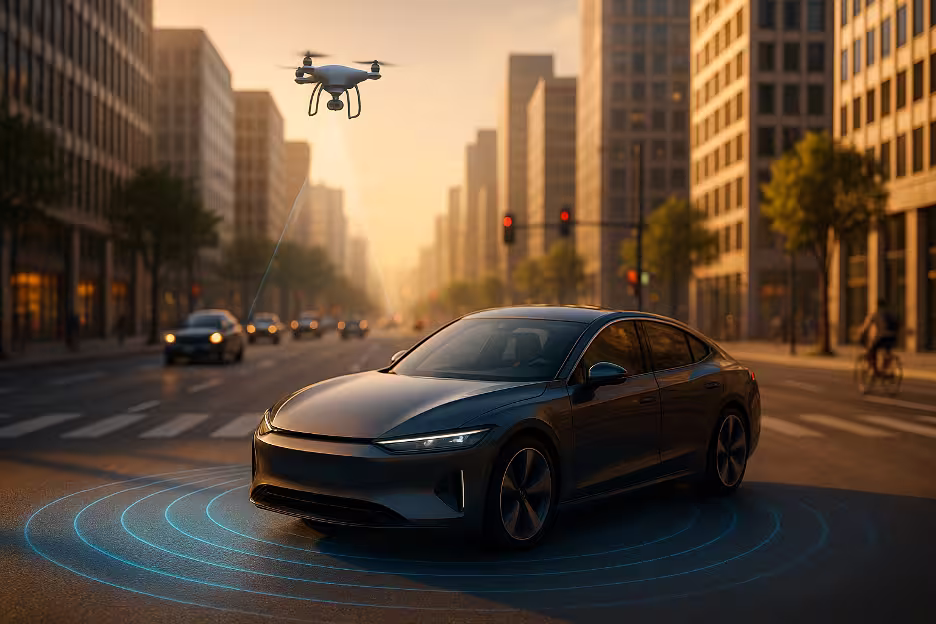
Autonomous mobility faces one of its toughest challenges in perception: how to see the world reliably in all conditions. Cameras struggle in darkness, lidar can falter in heavy weather, and conventional radar provided only a partial view, limited to distance and speed. The gap was clear — vehicles and drones needed a way to perceive their environments with greater accuracy and consistency.
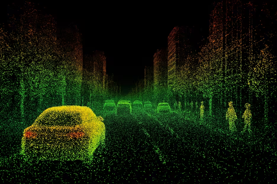
4D imaging radar answers this challenge. By combining distance, velocity, and position with vertical resolution, it provides a complete four-dimensional view of the world. Objects are no longer just “out there” at a certain range; they have precise shape, movement, and altitude within space. With this information, mobility systems can react in real time to obstacles big and small, making split-second decisions that improve safety in even the most complex environments.
Beyond Cars: Expanding Across Mobility
While cars remain a primary focus for 4D imaging radar, the technology’s influence now extends far beyond the road. Cities today are filled with smaller, agile forms of transportation — from delivery robots carrying packages to e-scooters weaving between pedestrians. These micro-mobility platforms operate in the tightest, most unpredictable spaces of urban life, where a minor error in detection could mean a collision.
Here, radar’s value becomes even clearer. High precision at low power consumption makes 4D imaging radar ideal for compact devices. Delivery robots equipped with radar can confidently navigate crowded sidewalks, while scooters and small autonomous shuttles can continuously scan for pedestrians or obstacles and adapt their movement in real time. Instead of depending solely on cameras or GPS, they gain an added layer of dependable perception that doesn’t fail when the environment becomes chaotic.
In effect, 4D imaging radar is democratizing advanced sensing — giving even the smallest vehicles in our cities a reliable set of “eyes” to move safely alongside people.
Drones Taking Flight with a 4D View
If 4D imaging radar strengthens safety on the ground, its role in aviation — particularly drones — is even more transformative. Drones operate in environments where challenges multiply: altitude shifts, changing wind conditions, narrow gaps between buildings, and areas where GPS signals weaken or disappear altogether. Cameras can provide visual cues, but their performance depends heavily on lighting and clarity.
Radar changes the equation. By delivering high-resolution 3D maps enriched with velocity data, drones can chart safe paths, avoid collisions, and adapt to sudden changes in their environment. A drone delivering medical supplies, for example, must avoid wires, maneuver through busy streets, and adjust instantly to wind turbulence. 4D imaging radar enables that level of resilience, ensuring it can complete its mission without compromising safety.
As the UAV industry expands into logistics, infrastructure inspections, and even passenger transport, radar will increasingly serve as a second set of eyes in the sky — one that sees consistently and reliably, regardless of conditions.
Toward a Connected Mobility Ecosystem
The promise of 4D imaging radar extends beyond individual vehicles or drones. The real breakthrough comes when these devices are networked into a larger ecosystem. The future of mobility is not about isolated smart machines, but about cars, robots, and drones sharing information seamlessly to create safer and more efficient environments.
With radar, this vision becomes possible. Each device generates rich spatial data that can be transmitted to central systems and analyzed by AI to coordinate actions. Imagine a city intersection where an autonomous car and a delivery robot both detect the same pedestrian. By sharing radar intelligence, they can anticipate one another’s movements and adjust their paths without conflict.
This kind of sensory network becomes the foundation for smart cities — a system where machines respond not only to their own perception but also to the collective intelligence of every connected device. The result is transportation that is safer, faster, and more synchronized with human needs.
Conclusion: Radar as the Eyes and Brain of Future Mobility
4D imaging radar represents more than a technical upgrade — it is reshaping the very architecture of mobility. By combining reliability with precision, it gives vehicles, drones, and micro-mobility platforms the ability to operate with confidence in any environment. Its influence reaches across industries, enabling safer streets, more capable skies, and the foundation of smarter cities.
At bitsensing, we see 4D imaging radar not just as a sensor, but as both the eyes and brain of tomorrow’s mobility ecosystem. From road to air, and from individual machines to entire networks, this technology is redefining how movement happens. The future of mobility is arriving quickly — and radar is leading the way.
bitsensing | Radar Reimagined